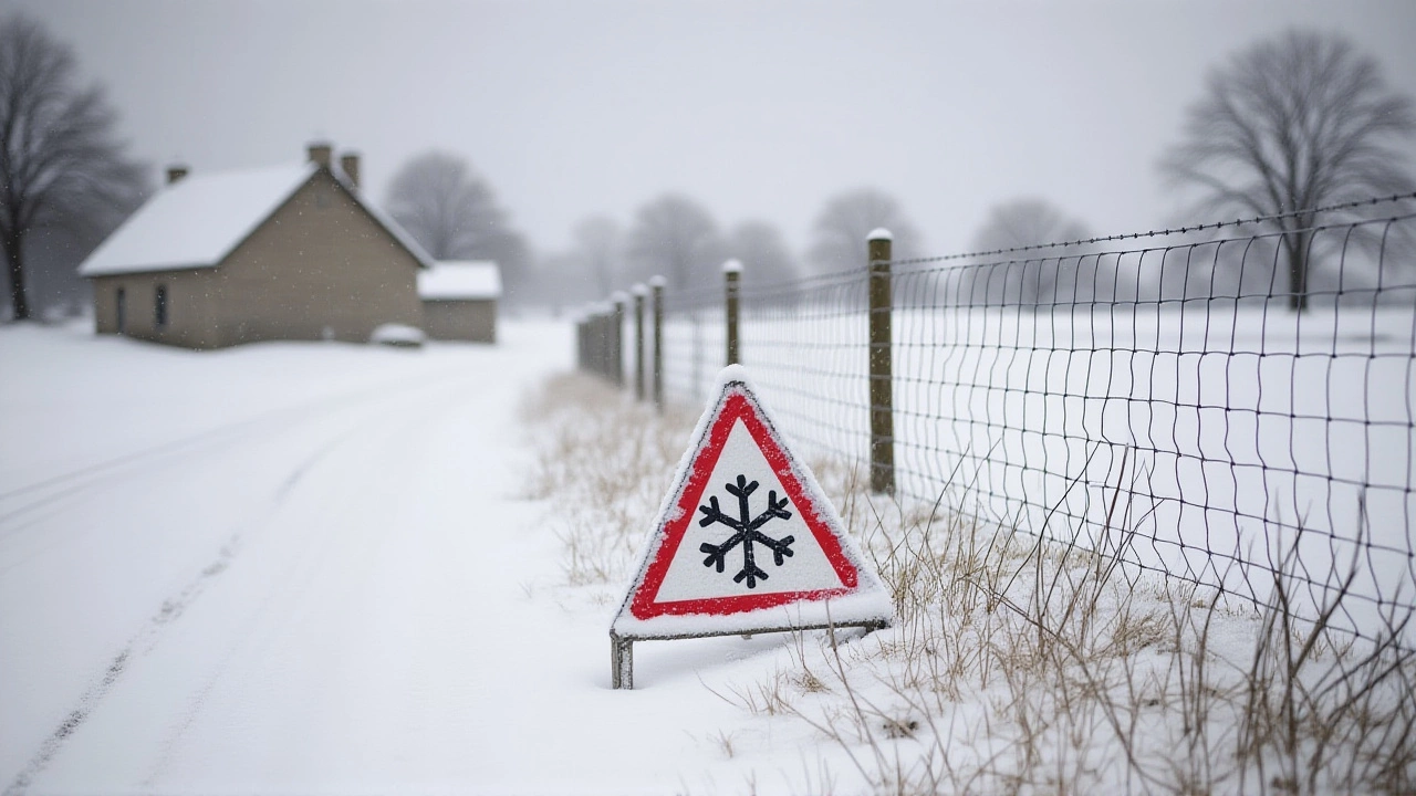
When the polar vortex stumbles, the Midwest holds its breath. That’s exactly what’s happening this week, as a dramatic atmospheric shift—detected on Thanksgiving week 2025United States—is poised to unleash a wave of bitter cold and heavy snow across the central U.S., potentially defining the entire winter 2025/2026 season. The trigger? A rare, early-season collapse in the upper-atmosphere wind pattern that usually locks Arctic air near the North Pole. National Oceanic and Atmospheric Administration (NOAA) confirmed the shift Monday, warning of heightened snow risk along the Great Lakes, where lake-effect storms can dump more than three feet of snow in under 48 hours. The timing couldn’t be weirder: just as families are finishing turkey leftovers, the weather may be turning deadly serious.
What’s Really Going on With the Polar Vortex?
The polar vortex isn’t some mythical beast. It’s a massive, spinning column of frigid air, roughly the size of Canada, swirling 10 to 30 miles above the Arctic. When its winds—called the polar jet stream—are strong and tight, they act like a fence, keeping the cold locked in place. But when those winds weaken, the vortex stretches, splits, or even flips inside out. That’s what’s happening now. According to ABC News reporter Kyle Reiman, this isn’t just a cold snap. It’s a structural failure in the stratosphere. Scientists call it a sudden stratospheric warming (SSW)—a counterintuitive name, because it’s not the ground that’s heating up. It’s the upper atmosphere, above 60,000 feet, where a rapid temperature spike disrupts the vortex’s spin. The result? Arctic air escapes like water from a burst dam.Why the Great Lakes Are Ground Zero
It’s not just any cold air that’s coming—it’s cold air moving over warm water. The Great Lakes, still holding summer’s heat in late November, act like giant steam rooms for the Arctic air rushing in from Canada. That’s lake-effect snow. And it’s brutal. In places like Buffalo, Syracuse, and Marquette, snow bands can form like conveyor belts, dropping 4 to 8 inches of snow per hour. NOAA specifically flagged this region as having “increased potential for heavy snow,” a phrase meteorologists use only when the risk is unusually high. States like Michigan, Wisconsin, Illinois, Ohio, Pennsylvania, and upstate New York are already bracing for travel nightmares, school closures, and power outages. One resident in northern Michigan told a local station: “We’ve had bad winters before. But this feels different. Like the system’s been rewired.”A Rare November Event
Most polar vortex disruptions happen in January or February. This one? It’s happening before Thanksgiving. That’s what made delainelebas.com—a respected independent meteorological blog—call it “unprecedented.” Delain Elbas, the blogger behind the site, noted in a November 24 post that model runs from the European Centre for Medium-Range Weather Forecasts (ECMWF) and the U.S. GFS system were showing “a blocked pattern forming in the upper atmosphere—a setup that might define early winter 2025.” The word “blocked” is key. It means the jet stream is stalling, creating a persistent cold dome over the Midwest instead of a quick, passing chill. This isn’t a one-week wonder. If the models hold, the cold could linger through December and into January.What Scientists Don’t Yet Understand
Here’s the twist: no one fully knows why this is happening. Climate change is often blamed for extreme weather, but the relationship with the polar vortex is messy. Some studies suggest warming in the Arctic is weakening the vortex by reducing the temperature difference between the pole and mid-latitudes. Others say natural cycles like the Madden-Julian Oscillation or even solar activity play bigger roles. NOAA and ABC News both quote scientists saying, “We’re still trying to understand these disturbances.” That uncertainty is what makes this so unnerving. We know the pattern is shifting. We know the snow risk is rising. But we can’t yet say if this is a one-off anomaly—or the new normal.What’s Next? The Winter Forecast Uncertainty
The next 72 hours will be critical. Forecasters are watching the stratosphere like hawks. If the SSW strengthens, expect a prolonged cold spell. If it fizzles, the cold may retreat by early December. Either way, the Great Lakes are already in a heightened alert state. Airlines are reviewing de-icing protocols. Emergency managers in Ohio and Michigan are stockpiling salt and sand. School districts are drafting remote learning plans. And homeowners? They’re checking furnaces, buying extra batteries, and stocking up on bottled water. One thing’s certain: this isn’t just weather. It’s a stress test for infrastructure, supply chains, and public safety systems that haven’t faced this kind of early-season freeze since 2019.Historical Echoes and Modern Risks
In 2014, a polar vortex event brought single-digit temperatures to Chicago and paralyzed the Midwest for weeks. Over 20 people died. In 2019, temperatures plunged to -40°F in parts of Minnesota. This year’s event doesn’t yet match those extremes—but it’s arriving earlier, and with more unpredictability. Climate scientists warn that as the Arctic warms faster than the rest of the planet, the jet stream becomes more wobbly. That means more frequent, more intense vortex disruptions. What used to be a once-a-decade event might now happen every three to five years. And with more people living in the snowbelt than ever before—thanks to urban sprawl in places like Grand Rapids and Toledo—the stakes are higher.Frequently Asked Questions
How will this affect holiday travel during Thanksgiving week 2025?
Travel disruptions are expected to be widespread, especially through the Great Lakes corridor. Major airports like Chicago O’Hare, Detroit Metro, and Cleveland Hopkins could see hundreds of cancellations as snow accumulates and de-icing crews struggle to keep up. Road conditions on I-90, I-94, and I-75 will deteriorate rapidly, with icy patches forming overnight. The National Weather Service has already issued advisories for 12 states, and the FAA is urging travelers to check flight status repeatedly.
Why is this polar vortex disruption happening in November instead of January?
While most vortex disruptions occur in mid-winter, recent decades have seen earlier events due to Arctic amplification—the phenomenon where the Arctic warms nearly four times faster than the global average. This reduces the temperature contrast that normally keeps the polar jet stream strong and stable. As a result, the vortex becomes more susceptible to stratospheric warming events even in late autumn. The 2025 event is unusual not just for its timing, but for the strength of the model signals predicting its persistence.
What does NOAA mean by ‘increased potential for heavy snow’ along the Great Lakes?
NOAA’s statement means the atmospheric setup favors prolonged lake-effect snow bands, not just general snowfall. These bands can produce snowfall rates of 2 to 4 inches per hour for 12 to 36 hours straight, with accumulations exceeding 40 inches in localized areas. The agency uses this phrasing only when model confidence is high and historical precedent suggests extreme outcomes are likely—similar to the 2014 Buffalo snowstorm that dropped 6 feet of snow in some neighborhoods.
Could this lead to a record-breaking winter overall?
Not necessarily. A strong early-season cold snap doesn’t guarantee a snowy winter. Some years, like 2015, saw a brutal December but a mild January and February. Others, like 2018, had consistent snowfall all season. What this does suggest is a higher probability of extreme events—more blizzards, more ice storms, more power outages. The key is persistence: if the jet stream remains blocked, winter conditions could dominate through February. But forecasters say it’s too early to predict total seasonal snowfall.
Is climate change directly causing this?
Not directly—but it’s making the conditions more likely. Research from the National Center for Atmospheric Research shows that Arctic sea ice loss over the past 20 years has increased the frequency of stratospheric warming events by 30%. That doesn’t mean every cold spell is caused by climate change. But it does mean the odds of extreme polar vortex disruptions are rising, and the U.S. Midwest is on the front lines.
How can people prepare for this kind of weather?
Start with basics: test your furnace, insulate pipes, keep a week’s supply of non-perishable food and water, and have flashlights and batteries ready. If you live near the Great Lakes, keep a snow shovel and ice melt on hand. Check your vehicle’s tires, antifreeze, and windshield fluid. And most importantly, avoid unnecessary travel during the peak window—November 25 through December 5. Local emergency management websites are posting real-time road conditions and shelter locations.